
# Survey optimisation
Optimizing where to collect more survey data
# Rationale
Mapping outcomes typcially requires collecting data at specific locations using surveys. These surveys are, however, expensive and time consuming to conduct, limiting their scale and frequency.
# Our approach
Designed to work alongside our spatial prediction algorithms, we have developed algorithms that identify the optimal locations to collect data based on proximity to other survey sites and the characteristics of each survey location. This ‘spatially optimised’ approach to sampling can bring huge efficiencies over conducting traditional random surveys.
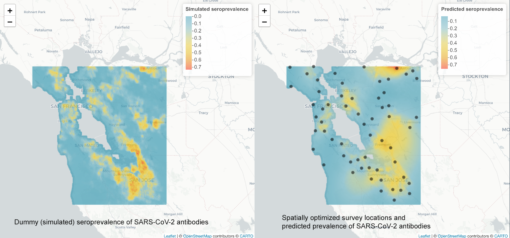 The images above contain only dummy seroprevalence data
For example, we tested how our survey optimisation and spatial prediction algorithms might perform in a sero-survey for COVID-19 in the San Francisco Bay area. We first ran the survey optimization algorithm to find the optimal set of initial survey locations. We then created a dummy (fake) map of seroprevalence which allowed us to simulate conducting surveys and enables us to see how well our methods perform. Simulations showed that by using a spatially optimised approach it is possible to achieve the same level of precision in predictions as a random sample, using just 60% of the sample size. The figure above shows an example of a dummy layer (left) and an optimized design (black dots) with associated predictions (right).
# Minimum required input
Set of coordinates of candidate locations
lat | lng |
|---|---|
| 1.1 | 1.1 |
| 1.2 | 1.2 |
| ... | ... |
# Who is using it?
These algorithms are being trialled for use in mapping lymphatic filariasis hotspots as well as vaccine coverage.
Think this sounds useful?
You can reach us at hello@locational.io to ask any questions, request additions or changes, or arrange a demo. We are actively developing these algorithms and would like to hear from you.